top of page
HOME
EVENTS
ABOUT
Municipal Info & Links
Political Maps
Iowa GOP
Our Schools
Central Committee
GET INVOLVED
ELECTED REPUBLICANS
VOTER INFO
Nov 3rd Election Info
Primary Election Resullts
2026 Primary Candidate Info
Past Election Results
Caucus to Convention
RESOURCES
Statewide Political Maps
Conservative News
Conservative Organizations
Podcasts
DONATE
More
Use tab to navigate through the menu items.
Emmet County GOP
Primary Results
Nov. 3rd Election Info
Political Maps for Emmet County
Voting Precincts & Polling Places
VOTING PRECINCTS AND POLLING PLACES pdf
Estherville Wards & Polling Places pdf
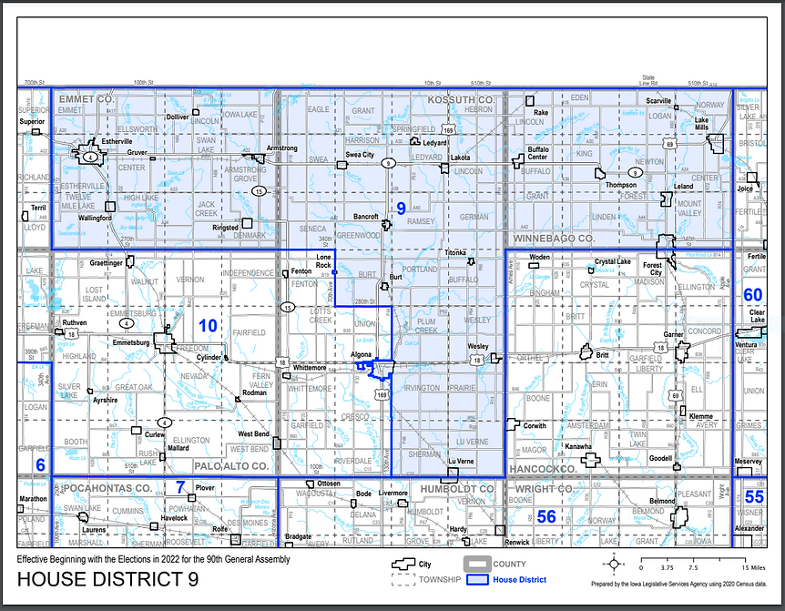
Iowa House District 9
Iowa House District 9 Map pdf
Iowa Senate District 5
Iowa Senate District 5 Map pdf
Iowa Congressional Districts Map
Iowa Congressional Districts Map pdf
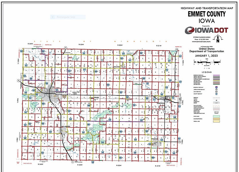
Emmet County Road Map
Emmet County Road Map pdf
Statewide Political Maps
Iowa Congressional Districts Map
Iowa Senate Districts Map
Iowa House Districts Map
Iowa Judicial Districts Map
bottom of page